 |
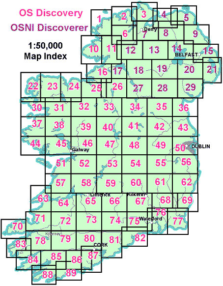
Ireland is covered by 89 1:50,000 maps. 71 are published in the Republic and 18 in the North. The good news is that the same grid system is used for all of Ireland. A different grid system is used in Britain. |
Picture from Peter Dana.

Links
| Brief Introduction | |||
| To be useful maps generally have to provide a means of identifying places exactly. For most small scale maps such as 1:50,000 scale this is done by printing a grid of lines representing 1 km squares over the map. | |||
| All small scale maps produced in the last 50 years in Ireland have used the national grid, even the old 1 inch to a mile and the city street maps. For many practical purposes the 1:50,000 map is the most useful. Every map includes instructions for specifying the grid reference for a place. | |||
|
|||
| In the national grid, Ireland is described as a square 500
km by 500 km. This is further divided into 25 100km squares, each of
which are given a letter.
Picture from Peter Dana. |
|
||
| A grid reference in Ireland looks like this: O 285 376 for a point on Howth in County Dublin. The initial letter, "O" in the example above, indicates the square. The two following numbers are the "easting" and the "northing". Within the O square there are 100 times 100 kilometre squares. The "285" indicates the 28th column of kilometre squares, the 5 means halfway across the square. The "376" indicates the 37th row of kilometre squares in "O". The 6 indicates 6/10 up that square. More information about this is included in textbooks and on any 1:50,000 Ordnance Survey map. | |||
| A simple grid reference therefore can resolve down to 10 points in each dimension within a kilometre square that is to 100m which for many purposes is fine. It means that any place in Ireland can be represented by just 6 digits and a letter. All that is required to do describe a position of a place is a map (well .. assuming that you know where the place is). | |||
Links |
|||
| Coordinate systems in various countries, including Ireland. | |||
| Irish Ordnance Survey | |||
| Northern Ireland Ordnance Survey | |||